The news arrived, as these things often do, in a single unremarkable sentence: Airbus is about to launch a tiny satellite that will see the Earth at 20-centimeter resolution. On paper, that line looks almost boring. In orbit, it’s anything but. It’s a whisper that could redraw maps, rewrite business plans, and quietly transform how we watch our restless, changing planet.
A Pinprick of Metal, A Flood of Detail
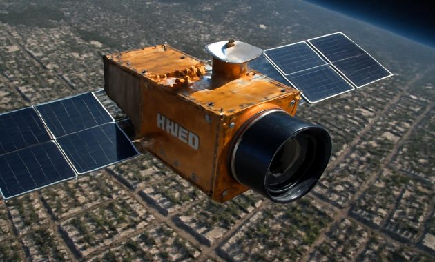
Look up on a clear night and you won’t see it—not with your eyes, not even if you know exactly where to stare. This new satellite will be small, a compact box of technology riding high above the atmosphere, hidden in the unblinking darkness. It will look nothing like the old stereotype of a massive bus-sized spacecraft. This is a gem: dense, efficient, almost understated. But the pictures it will send back? Those will be loud.
Twenty centimeters. About the length of your hand from wrist to fingertips. That is the size of the smallest objects this satellite will be able to distinguish from orbit. A curb. A road marking. The boundary between one crop row and the next. A solar panel glinting on a factory roof. The shadow of a small boat inching along a river mouth.
The Earth, seen every day in news graphics and weather forecasts, can seem like a soft watercolor wash of cloud and land. This little spacecraft sharpens that painting into something almost tactile, something you can imagine stepping into. Airbus isn’t just adding another eye in the sky; it is pushing commercial Earth observation into a realm that—until now—belonged mostly to rumors and government black boxes.
The Quiet Arms Race in the Sky
To understand why this matters, you have to tune yourself to the hum of a quiet competition that has been building over the last decade. There is an invisible race happening above us: who can see more, faster, sharper, and more cheaply from orbit?
Walk through any major Earth observation conference these days and you hear the same phrases over and over: “higher resolution,” “faster revisit,” “lower cost per square kilometer.” Companies unveil constellations like someone revealing a hand of cards in a high-stakes game. One meter resolution. Fifty centimeters. Thirty. Each improvement opens new markets, new customers, new uses that yesterday’s imagery just couldn’t support.
Airbus has never been a quiet player in this game. From its long line of optical satellites to radar missions that can see through clouds and darkness, it has built a reputation for images that global mapping agencies, analysts, and cartographers rely on. But this new satellite, with its 20 cm world record, is a different kind of statement. Not only is the resolution razor sharp—it is housed in something far smaller and more agile than the behemoths of the past.
Imagine shrinking a professional cinema camera, with all its lenses and stabilization, into something the size of a large shoebox and then strapping it to a rocket. That is roughly the engineering challenge Airbus and its partners have had to navigate: fold the precision optics, detectors, data systems, and attitude control of a flagship satellite into a compact platform that can share a rocket ride with dozens of others.
How 20 Centimeters Changes What We Notice
If you’re not used to thinking in satellite resolutions, “20 cm” might feel abstract, like a technical brag at the end of a press release. So picture this: spread out a city map on a table. At one-meter resolution, you see the broad strokes—the rough shape of buildings, the width of roads, the green of a park. At 50 cm, cars become distinct, lines in parking lots appear, small boats start to separate from the fuzzy blue of the harbor.
At 20 cm, details enter that feel almost uncomfortably close. You don’t see faces—that remains well beyond the reach of even this spacecraft. But you do see the geometry of daily life. The painted arrow on a highway lane. The pattern of tiles on a rooftop. The way tram tracks bend by a station. The individual panels of a large solar farm, laid out like scales on the land.
From that vantage point, the planet becomes a living diagram of human intention. Every line, every surface, every sharp corner is a decision someone made: to build a wall here, to clear a field there, to carve a new road through what used to be forest. The satellite doesn’t just see the Earth; it sketches the stories of our choices at astonishing clarity.
And these stories are not fixed. High-resolution satellites don’t just take a single postcard picture. They revisit. Again and again. They watch the same city grow block by block, see a new wind farm appear over months, track how quickly a glacier’s edge retreats year after year. Marry 20 cm detail with frequent revisits, and suddenly you have something like time-lapse photography of civilization itself.
The New Eyes of Industry and Science
The leap to 20 cm resolution is more than an engineering victory; it’s a door opening into new commercial and scientific frontiers. For years, industries have been quietly reshaped by space imagery. Farmers use it to measure crop health. Insurers use it to assess flood damage and wildfire risk. Urban planners trace the sprawl of suburbs, freight companies track congestion, telecoms refine where to place their towers.
Now imagine each of those tasks performed with finer detail. A farmer can see subtle irrigation flaws between rows, not just across whole fields. A port operator can distinguish types of containers or vehicles more quickly, optimizing how cargo moves. A city can measure, almost building by building, where tree cover is missing and where heat islands form in summer. A rail company can monitor how close vegetation creeps toward its tracks with far less guesswork.
This small Airbus gem turns the Earth into something closer to a living spreadsheet, with almost every square meter holding measurable, trackable data. And because the spacecraft is smaller and, in many ways, simpler to deploy than its big siblings, it hints at a future where a cluster of such satellites could watch different slices of the world in near real time.
Scientists, too, will feel the impact. Research teams already use satellite imagery to map coral bleaching, illegal logging, informal settlements, pollution plumes, and ice fractures. Finer resolution allows them to pick up early patterns: the first cuts of a new forest road that might lead to wholesale deforestation, the first rows of informal housing on a floodplain, the earliest cracks in a vulnerable glacier tongue. Tiny signs that, once detected, could change the course of policy and prevention.
The Art of Shrinking a Giant
Behind the romantic language of “gems” and “eyes in the sky” lies an unforgiving checklist of physics. Light has to bounce off the Earth, travel through the thin upper air, enter a tiny telescope, fall onto a sensor, and then be translated into numbers that race down to antennas on the ground. Every step introduces noise, blur, heat, motion, and the unyielding demands of orbital mechanics.
Traditionally, very high-resolution images demanded large satellites. Big mirrors. Big structures to keep them rigid and stable. Big fuel tanks to hold them steady against the invisible pushes and pulls of space. But big is expensive. It’s slower to build, riskier to launch, and harder to replace.
The real quiet revolution, tucked inside Airbus’s announcement, is that the company has succeeded in miniaturizing so many pieces of the puzzle without giving up precision. Lighter mirrors or lenses. Hyper-efficient attitude control—those small thrusters and reaction wheels that keep the spacecraft pointed exactly where it should stare. Detectors that sip power but drink in light. Onboard processors that compress gigabytes of raw data into something the downlink can handle.
Shrinking a satellite is like trying to condense an entire observatory into a backpack while hiking up a mountain: every gram counts, every watt matters. You trade, optimize, pare back, and refine until every component earns its place.
| Feature | Traditional Large EO Satellite | New Airbus Small “Gem” |
|---|---|---|
| Typical Resolution | 0.5–1.0 m | 0.20 m (world record class) |
| Satellite Size | Bus-sized, over 1 ton | Compact, small-satellite class |
| Launch Flexibility | Dedicated launches, higher cost | Rideshare friendly, lower cost |
| Constellation Potential | Small number of flagship satellites | Larger constellations, faster revisits |
| Target Users | Governments, large institutions | Governments plus agile commercial markets |
The payoff is not simply one record-setting instrument, but a template. If Airbus can build and fly one such satellite, it can build a family—each gem tuned slightly differently, some for color, some for stereo 3D mapping, some perhaps for special spectral bands that reveal plant health or mineral signatures. The era of one mighty all-seeing platform may quietly yield to an age of coordinated swarms.
Leaving Rivals in the Contrail
In any race, moments arrive when a competitor makes a move that is more than a small lead—it’s a psychological break. A signal that the bar has moved. For Airbus, a 20 cm small satellite is one of those moments. It tells the world: “We can do more with less mass, and we can deliver images so fine that you will have to rethink what’s possible from space.”
Other companies are not standing still. Startups and established players alike are designing their own micro-constellations, some focused on video from orbit, others on thermal images, others on radar that can pierce clouds. But resolution is a headline metric. When a customer compares providers, the number that says “20 cm” next to Airbus’s offering will stand out.
Rivals will respond. They may seek to match the resolution, alter their business models, or double down on different strengths like daily global coverage or ultra-fast tasking. This is how innovation compounds: one leap forces everyone else to jump or risk being left in the vapor trail.
Airbus also carries an intangible advantage: trust. Its heritage satellites have anchored national mapping programs and security analyses for years. With that heritage flowing into a smaller, more nimble platform, the company can offer the comfort of reliability wrapped in the thrill of cutting-edge capability. It’s like a seasoned mountain guide suddenly showing up with a lightweight pack and high-tech gear, ready to climb faster than ever.
The Planet Under a Sharper Gaze
Any time we sharpen our tools for looking at the world, we also sharpen our questions. What does it mean to have this level of detail, available commercially, watching over every port, every highway interchange, every plantation, every coastline?
For many, the benefits are immediate and obvious: better disaster response, smarter infrastructure planning, more efficient logistics, deeper environmental insight. In a flood, 20 cm imagery can help responders see which streets are genuinely passable, which roofs are intact, where temporary shelters can safely stand. After an earthquake, it can reveal subtle structural damage that blockier resolution might miss. For conservation groups, such detail can pinpoint illegal road building inside protected zones before the clearing turns into a scar of deforestation.
Yet the power of such vision also demands responsibility. Airbus, like other providers, must navigate legal limits, export controls, and the invisible line where acceptable observation might begin to feel like surveillance. At 20 cm, you cannot read a license plate or identify a person, but you can certainly count vehicles, trace patterns of movement, and infer a great deal about how a place is used and by whom.
The most hopeful future is one where this precision gaze is harnessed openly and thoughtfully: where cities use it to keep citizens safer, climate scientists to protect fragile ecosystems, businesses to cut waste and emissions. Where the satellite’s memory card fills with images that nudge us toward better stewardship of the only home we have.
Rockets, Waiting
Somewhere, as you read this, a rocket fairing is being prepared. Inside that protective shell, space will soon be cleared for a small box of exquisitely crafted hardware that has no idea how important its mission will be. Engineers run through checklists. Software is updated and simulated. Thermal blankets are cut and fastened. A name, perhaps poetic or technical or both, is stenciled on a side panel.
Launch day will come the way it always does: with a mix of routine and awe. The countdown. The ignition flare painting the sky. The low thunder rolling across concrete and grass. For the people who designed and built this satellite, those seconds of ascent stretch like hours. Every stage separation, every shift of telemetry on a screen, is a small held breath released.
Then, at last, the satellite will separate from its rocket and drift into the black. For a moment, it will be utterly alone—just one more manufactured object in a heaven already thick with them. Then it will wake. Antennas unfold, star trackers open their eyes, reaction wheels spin up. On the ground, operators send the first commands. The tiny gem begins to orient itself, to feel the subtle pull of Earth, to find the curve of the planet below.
The first image is almost never perfect. It’s a calibration shot, a test of focus, a careful adjustment. But somewhere in those early frames—grainy at first, slightly misaligned—is the promise of everything that is to come: a planet rendered in crisp, almost startling detail, seen by a machine that was just a diagram a few years ago and is now a silent witness in orbit.
Looking Back at Ourselves
There’s a quiet irony in all of this. We go to extraordinary lengths to leave Earth—to ride towers of fire into orbit—only to spend much of our time up there looking back. Airbus’s new satellite, with its 20 cm gaze, is part of that long tradition of self-scrutiny from the edge of space.
We used to draw maps from the ground, walking and measuring, guessing the shape of coastlines and mountain ranges. Then came airplanes, then the first grainy satellite images that showed our cities as faint smudges and our rivers as gray ribbons. Each step gave us more perspective and, if we were wise, a little more humility.
Now, as a small high-tech jewel prepares for its launch, we stand on the threshold of seeing our own works and wounds with even finer clarity. The satellite can’t decide what we do with that knowledge. It can’t choose whether its images fuel better planning or sharper exploitation, deeper empathy or colder calculation. That choice stays down here, with us.
But the opportunity is undeniable. In the coming years, as Airbus’s new spacecraft sends back image after image of ports and prairies, ice fields and industrial parks, forests and freeways, we will know more, more quickly, about the state of our world. We will see where we are growing and where we are shrinking, where we are greening and where we are burning, where we are building walls and where we are opening paths.
High above, the gem will keep circling, blind to politics and money and desire, patient and precise, capturing the patterned light bouncing off the only known living world. Rivals will chase its resolution, new records will eventually surpass it, rockets will rise and fall. But for a certain stretch of time, that compact machine will hold a world record that is more than a number—it will be an invitation to look harder at ourselves, and, perhaps, to choose better what we build next on the ground it sees so well.
Frequently Asked Questions
What does 20 cm resolution actually mean?
It means each pixel in the image represents an area on the ground roughly 20 centimeters by 20 centimeters. The satellite can distinguish objects that are about that size or larger as separate features, allowing very fine details like lane markings, small boats, and rooftop structures to be visible.
Can this satellite see people or read license plates?
No. Even at 20 cm resolution, individual people appear as tiny shapes or dots, and license plates are far too small and blurred to read. The system is designed for mapping, infrastructure monitoring, environmental analysis, and similar applications, not personal identification.
Why is it important that the satellite is small?
A smaller satellite is cheaper and faster to build, easier to launch as a rideshare payload, and makes it feasible to deploy multiple copies into orbit. That means lower costs per image and the possibility of more frequent coverage by future constellations.
How will this new resolution be used in practice?
Industries can use it to monitor infrastructure, optimize logistics, track construction, and assess damage after disasters. Scientists can use it to study urban growth, deforestation, coastal erosion, glacier retreat, and other environmental changes with far greater precision.
Is there any regulation on such high-resolution imagery?
Yes. High-resolution commercial imagery is subject to national and international regulations, export controls, and licensing policies. Providers like Airbus must comply with these rules, which set limits on how and to whom some data can be sold or distributed.